Landscape & Geoarchaeology
Author: Janoscha Kreppner | last update: 2023-01-03
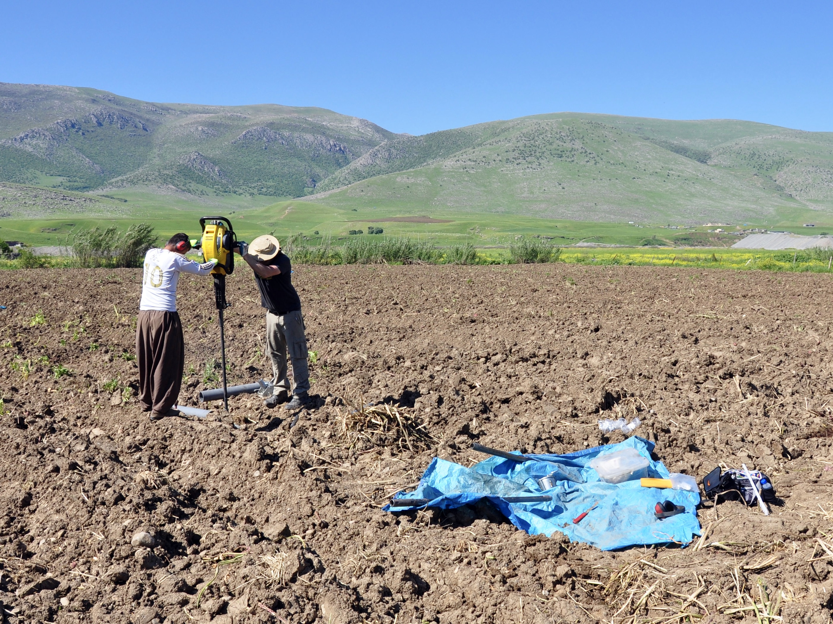
Mark Altaweel, Eileen Eckmeier, and Cajetan Geiger have intensively investigated the ancient environment of the Bora Plain using geophysical methods, coring, soil and sediment analysis, and geological surveying. These environmental studies have been carried out with the aim of clarifying the geological setting, the formation processes of the alluvial Bora Plain, and the relationship between the Dinka Settlement Complex and its surroundings.
Further Reading:
Archaeological Surface Survey
Author: Janoscha Kreppner | last update: 2023-01-03
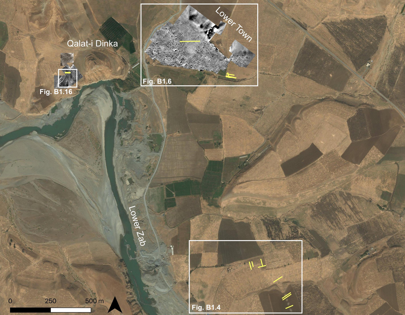
The French archaeological surface survey team of the Mission Archéologique Française du Gouvernorate de Suleimaniah (MAFGS) led by Jessica Giraud, and with Jean-Jacques Herr serving as the pottery expert responsible for the Iron Age ceramics, identified 47 sites in the Peshdar Plain that were assigned to the "Neo-Assyrian period" on the basis of surface pottery.
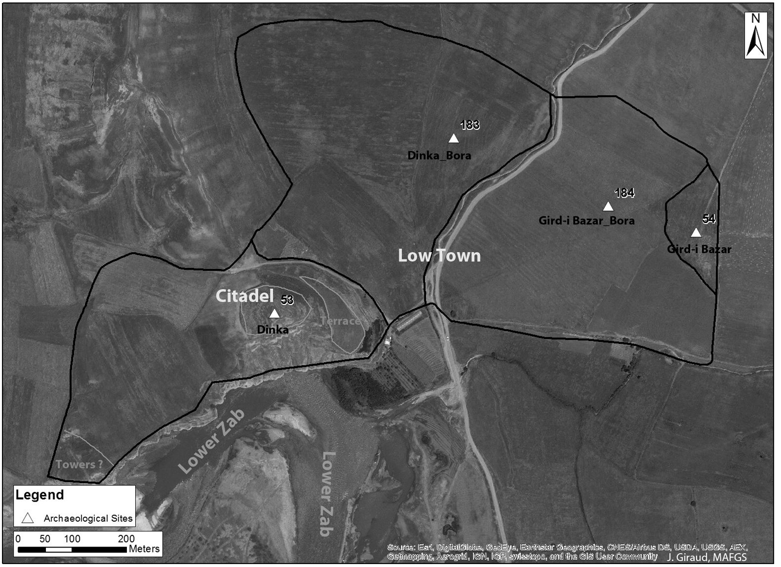
The data from the 2013 and the 2015 MAFGS survey campaigns indicate that the Dinka Settlement Complex was occupied from the Chalcolithic into the Islamic period, with its peak occupation level during the Iron Age. Combining all the excavation results with the geophysical and the surface pottery surveys reveals that the Dinka Settlement Complex also reached its largest geographical size of about 60 ha during this period, with a ca. 10 ha citadel and a ca. 50 ha lower town.
Further Reading:
- 4P1, B3 [10MB]
- Herr 2018, J.-J. Herr, "Neo-Assyrian Settlements in Rania, Peshdar and Bngird". In: R. Salisbury, F. Höflmayer and T. Bürge (eds.), Proceedings of the 10th International Congress on the Archaeology of the Ancient Near East, vol. 2. Wiesbaden 2018, 97–112.
Magnetometer prospection
Author: Janoscha Kreppner | last update: 2023-01-03
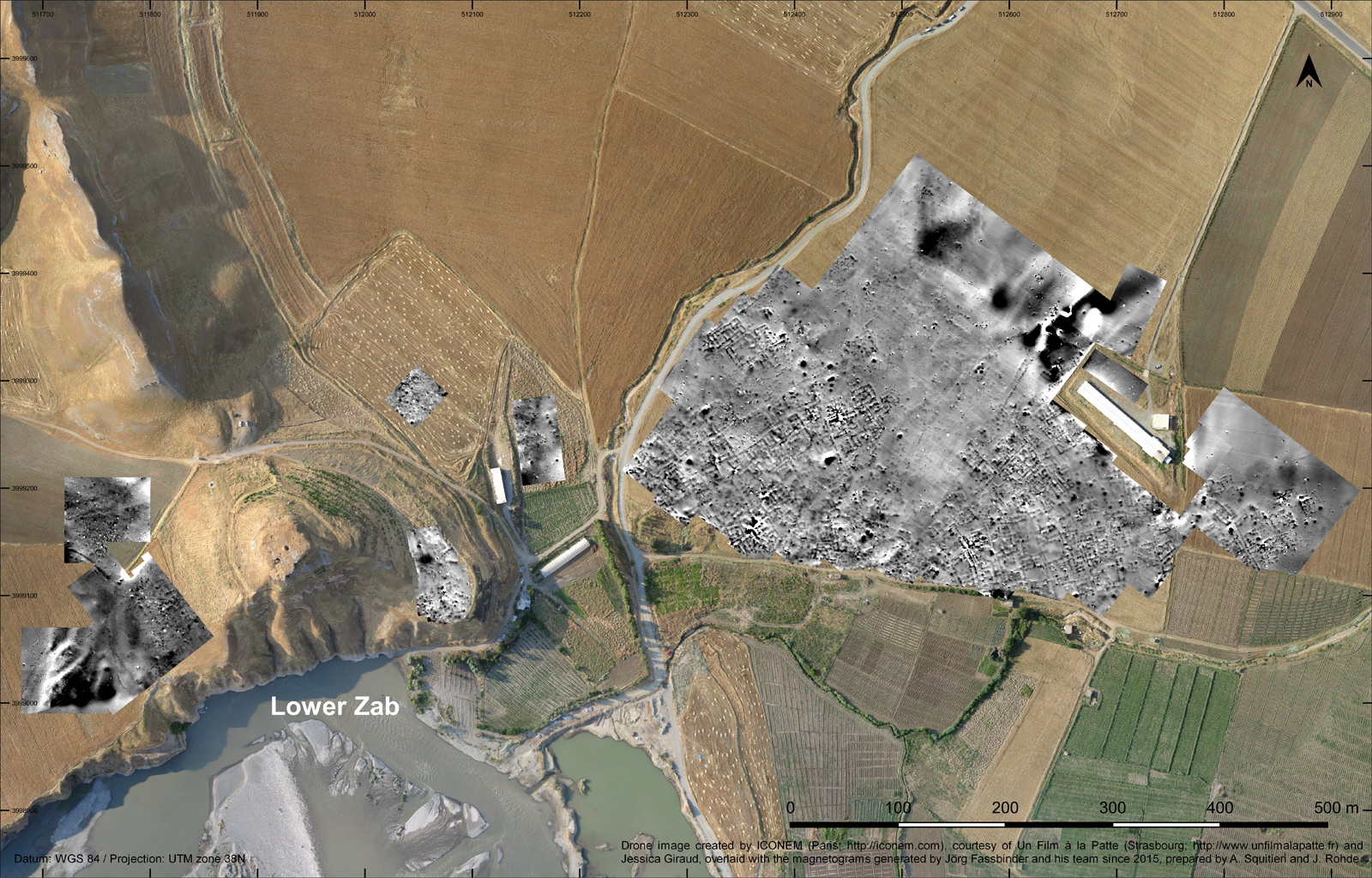
The magnetometer prospecting was led by Jörg Fassbinder and carried out in collaboration with Andrei Ašandulesi and Marion Scheiblecker. On the western slope of Qalat-i Dinka, the settlement is divided into two areas by a quarter-circular anomaly visible on the magnetometer image. The anomaly encloses an area of up to 200 m near the crest of the hill. Excavations in QID-2 and QID-3 confirmed that it is a fortification. The image of the magnetometer prospection between Qalat-i Dinka and Gird-i Bazar shows that the area between Gird-i Bazar and Qalat-i Dinka was densely covered with buildings that are separated by streets and alleys. The road system and blocks of buildings are oriented and organized in a semicircle around Qalat-i Dinka. At a slightly elevated position, a complex of three larger buildings is situated on the edge of the settlement (DLT-2). The magnetometer image shows that no city wall protects the lower city.
Further Reading:
Electrical resistivity tomography
Author: Janoscha Kreppner | last update: 2023-01-03
Electrical resistivity tomography investigations were carried out under the supervision of Mark Altaweel in collaboration with a team from the University of Sulaymaniyah's department of Geology, under Bakhtiar Qader Azis, in autumn 2016 and spring 2017. They confirmed at least two extended stretches of a qanat system in the Bora Plain.
In 2019, additional ERT measurements were carried out by Jörg Fassbinder and Mandana Parsi, to further investigate the qanats of the Bora Plain and to obtain additional information about the archaeological features of the Dinka Settlement Complex. The results from the ERT profiles measured in the south-eastern part of the Bora Plain shows the possible presence of closed shafts, at a depth of around 1.7 m. Artificial anomalies in the ERT results close to the Lower Town of the Dinka Settlement Complex represent the remains of artificial structures. Whether they belonged to buildings is not clear. It is possible that these remains are located next to elongated features which may represent an accumulation of coarse gravel and could be interpreted as pavement or floor. The section in the Lower Town (Profile 17) revealed older structures below the Iron Age level, which could belong to the Chalcolithic/Early Bronze Age periods. The two Profiles of the western slope of Qalat-i Dinka reveal structures which can be interpreted as the continuation of the glacis structure unearthed during the 2018 excavations in trench QID2, thus proving that the glacis continued an additional 6.5m south of QID2; additionally, the profile revealed the existence of a wall or palisade next to it.
Further Reading: