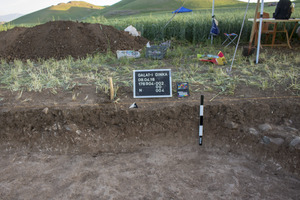
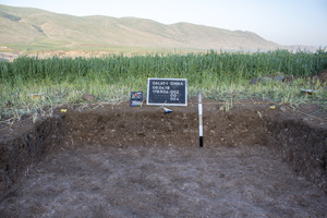
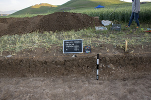
Locus:176904:004
Filling: Filling until virgin soil W of wall .003 (10x2m area)
Administration
| Beginning | 08.04.2018 |
| Ending | 08.04.2018 |
| Liters | 4725 |
Description of the Locus
| General Description |
Filling west of wall 176904:003, red brown crumbly silty soil with calcite inclusions and a high amount of small pebbles, some gravel. Nearly not pottery is present in the locus, in the lower part of it pottery is completely absent. This locus represents virgin soil in QID 3. In the corresponding section, some traces of a settlement deposit layer at the top of this locus are visible. A thin band of pebbles indicates the presence of a use horizon that belongs to Locus:176904:003. But this layer must have been heavily disturbed, due to it closeness to the (ploughed) surface. This layer is documented on the first photos of 08.04.2018. Therefore this locus represents a mixed context that was unwittingly excavated down to virgin soil. It contains layers that might be correlated with neighbouring Locus:176904:009 and Locus:176904:018 and others (?). |
| Boundaries (Contrast, Topography) | Covered by 176904:002. The locus is limited to the W, N and S by the excavation edge, in the E it is cut by the foundation pit cut (Locus:176904:016) of stone wall 1760904:003 which thereby constitutes the lots eastern limit in its upper half. |
| Consistency (Components, Colours) | |
| Interpretation & Classification of the Locus |
Collections
Singlefinds
Samples
| 176904:004:004 |
| Earth for flotation |


